Meteorological data for current / selected location in Israel
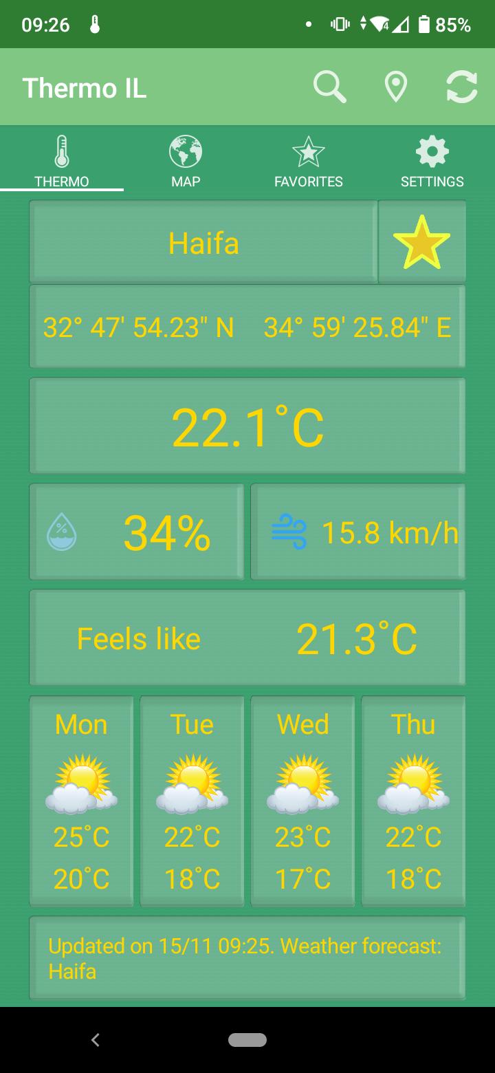
‘Thermo IL’ shows updated meteorological data for current location or a selected location in Israel. Data shown includes: temperature, humidity, wind speed, apparent temperature (feels like) and 4-day weather forecast for nearest available forecast location. An Internet connection is required.
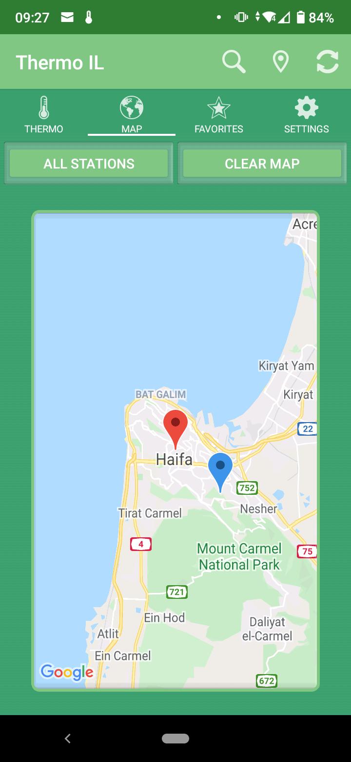
Locations can be selected from a list using the ‘magnifying glass' button in the action bar or by using a map. The location is shown on the map and optionally the data source meteorological station (map tab).
Data can be refreshed manually using the refresh button in the action bar (right).
Change to current location is done by tapping on the ‘pin’ button in the action bar.
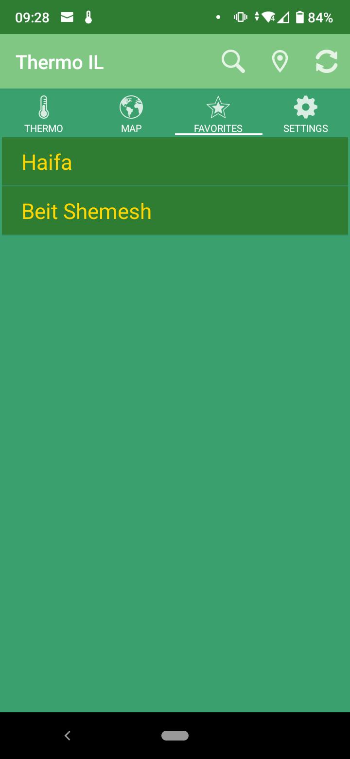
Favorite locations can be saved and stored (locally) using the 'star' button (to the right of the location name) in the ‘thermo’ tab.
Option for showing a notification in the notification drawer for a location (current / selected) that is active when the app is not running and is updated every set interval (chosen by the user). Displaying temperature, apparent temperature, humidity and wind speed and the update timestamp. In the settings it's possible to change user interface language (English / Hebrew / Russian / Arabic), change temperature units (C°/ F°), toggle meteorological station display on map, enabling / disabling the notification and setting notification interval.
Features
Data shown is from measurements taken about one hour before (every 10 minutes). Data is acquired from the Israel Meteorological Service.
Temperature and wind speed can be shown in Celsius and km/h or Fahrenheit and mph respectively.
Apparent temperature is calculated using heat index formula in warm weather and wind chill formula in cold weather.
4-day weather forecast is shown for nearest forecast location (from 15 total locations around Israel).
Map has zoom out / zoom in animation when a new location is set, by this showing geographical area of location in the country.
A long touch on a map location will start loading data for the touched area and show the bounding area of the meteorological station and nearest town (if ‘show station on map’ is enabled).
Temperature data is also displayed by touching the meteorological station pin (blue) info on the map. User interface language change includes location names and map.
Current temperature data of all meteorological stations can be displayed on map ('all stations' button in map tab)
What's New in the Latest Version 1.7.3
Last updated on Oct 4, 2023 Critical fix: weather and temperature data not updating